
A recent question from a newcomer to the Society reminded me that our system of branches is not particularly intuitive, and spurred me to put together this simple visual overview, which leaves out a lot of potential complications in order to focus on the most common elements of the structure.
The SCA is organized as a number of regional chapters, each of which has its own internal subgroups.
This diagram shows the most common group types, but for historical reasons there are also lots of exceptions.
Every group has a local set of officers; gold crowns mark the groups which are also led by titular nobles.
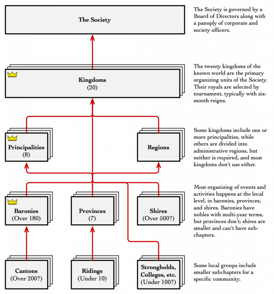
When it comes to the smaller branches, some of these come and go every year, and it’s difficult to be sure how many of the groups are currently active; I imagine that the Society Seneschal has a list, but as far as I can tell it is not published anywhere.


